IIT Bombay Hosts National Geospatial Awards 2024 and Open Source GIS Day Celebration
11 Oct 2024
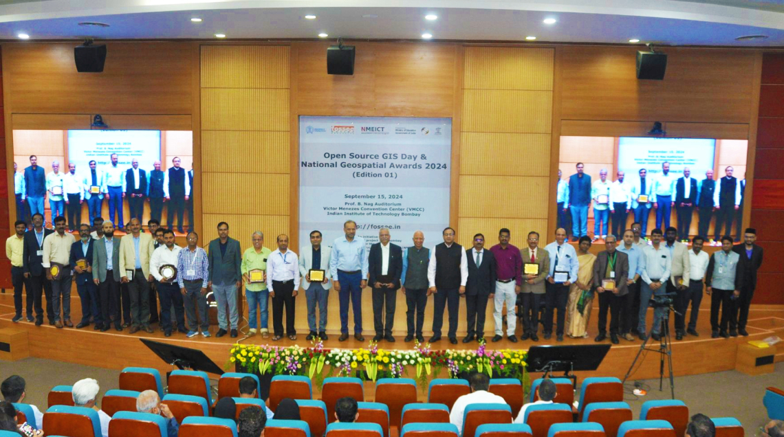
IIT Bombay proudly organized its inaugural Open Source GIS Day celebrations, alongside the presentation of the National Geospatial Awards 2024 (Edition 01).
This initiative is part of the FOSSEE (GIS) project, conducted under the National Mission on Education through ICT (NMEICT), Ministry of Education, Government of India. The primary aim of the National Geospatial Awards is to recognize individuals and organizations that have significantly contributed to the advancement of geospatial technology in India, spanning various professions.
Prof. Shireesh Kedare, Director of IIT Bombay, distributed the awards including The National Geospatial Enabler Award and the National Geospatial Faculty Fellows. Honourees included:
- The National Geospatial Enabler Award:
– Survey of India
– National Remote Sensing Center (NRSC-ISRO) Hyderabad
– ISRO’s SATNAV Programme
– North East Space Application Center (NESAC-ISRO)
- National Geospatial Faculty Fellow Category
– Prof. R. D. Garg (IIT Roorkee)
– Prof. RAAJ Ramasankaran (IIT Bombay)
– Col. Prof. Karbhari Kale (Vice Chancellor, DBATU)
Mr. Mohamed Kasim Khan, the National Coordinator for FOSSEE GIS under NMEICT, skilfully coordinated the event, ensuring its success and impact. The event also featured insightful addresses, including a keynote by Prof. Kannan Moudgalya, P.I. of FOSSEE, who discussed the evolving landscape of geospatial technology. Prof. Pennan Chinasamy, Co-P.I. of FOSSEE, emphasized the significance of celebrating Open Source GIS Day in fostering collaboration and innovation.
The National Geospatial Awards 2024 and Open Source GIS Day celebration at IIT Bombay highlighted IIT Bombay’s commitment to fostering innovation and collaboration in geospatial technology and reinforced the importance of open-source tools in the advancement of the field. By recognizing the contributions of key organizations and individuals, the event served as an inspiration for future advancements in the field, encouraging ongoing engagement between academia and industry in harnessing the potential of geospatial tools.